Gathering data in and around Greenland will help answer major systems questions
GIANT’s field campaigns will take researchers to the edge of the Greenland Ice Sheet — where towering glacier walls meet turbulent seas. We will uncover how ice interacts with ocean waters using cutting-edge drones, marine robots, satellites, and sensors.
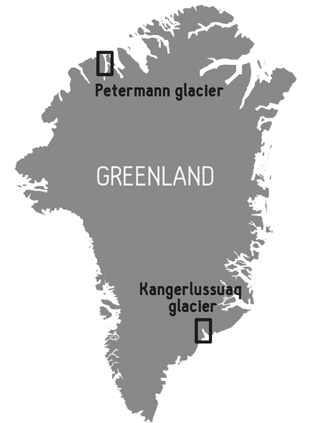
We will study two of Greenland’s most important glacier regions: near Kangerlussuaq in the southeast and Petermann in the northwest. Each offers a different window into how ice behaves as it meets the ocean, and what is driving ice loss.
Steep fjord glaciers like Kangerlussuaq are melted by the ocean from the front — weakening their structure and accelerating iceberg calving. This can lead to rapid retreat, especially if the protective mélange of ice fragments and bergs in the fjord disappears. Petermann in the north has a long, floating ice tongue that melts from below, retreating the glacier front and accelerating ice flow.
Over two fieldwork expeditions, the project will:
- Gather high-resolution underwater observations of glacier melting using robotic submarines
- Study how turbulent upwelling plumes of meltwater pull warm ocean water towards the ice
- Capture satellite and drone imagery to track glacier thinning, fracture and calving in real time
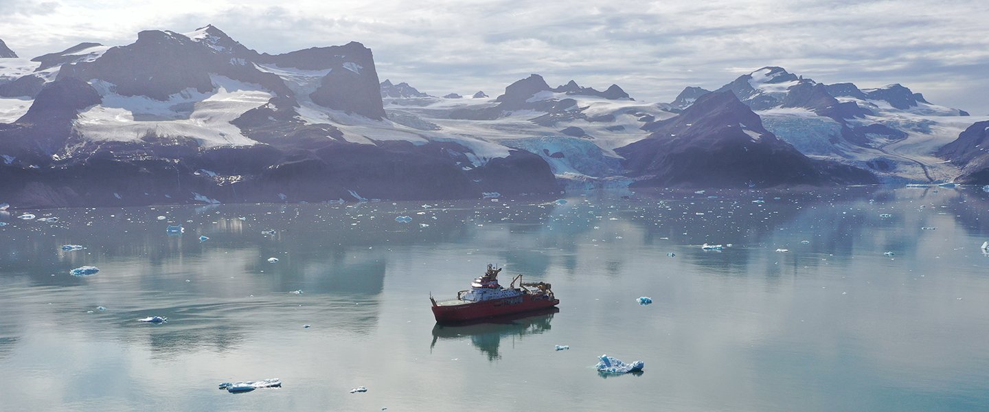
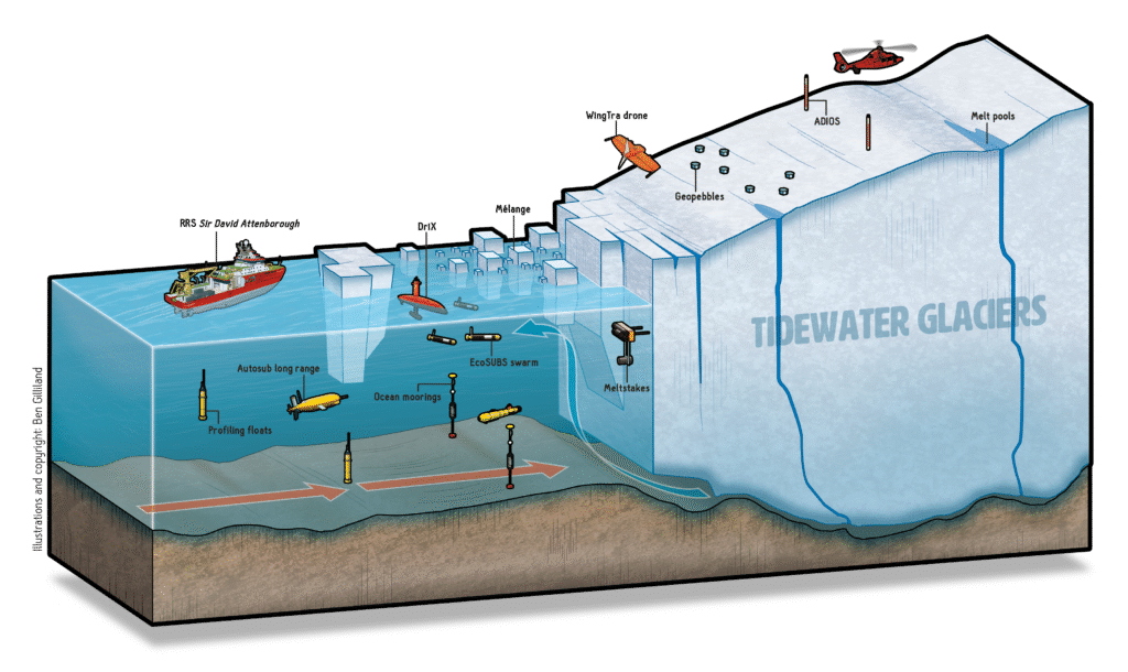
The research will use the RRS Sir David Attenborough as its flagship platform, deploying fleets of autonomous vehicles to map, measure, and monitor everything from ocean water temperature to glacier movement.
The findings will feed into new computer simulations that better represent how Greenland’s glaciers influence ocean circulation and sea-level rise — critical knowledge for predicting our planet’s future.
Deploying the fleet
GIANT’s hugely ambitious fieldwork campaigns will deploy an arsenal of monitoring equipments with a short time period to understand two major glaciers. Both expeditions will use uncrewed aerial and underwater vehicles for precision mapping, drone scanning and seismic sensors to monitor ice cracking and calving, and profiling floats and satellites to measure ocean conditions year-round.
Tidewater glacier fieldwork
The RRS Sir David Attenborough will lead operations at tidewater glaciers near Kangerlussuaq Fjord, deploying marine robots such as DriX, Gavia, and Autosub Long-Range (also known as Boaty McBoatface) to map the glacier’s underwater face. Drones will survey the ice from above, while embedded robotic sensors track melting below the surface. This expedition will take place in July and August 2026.
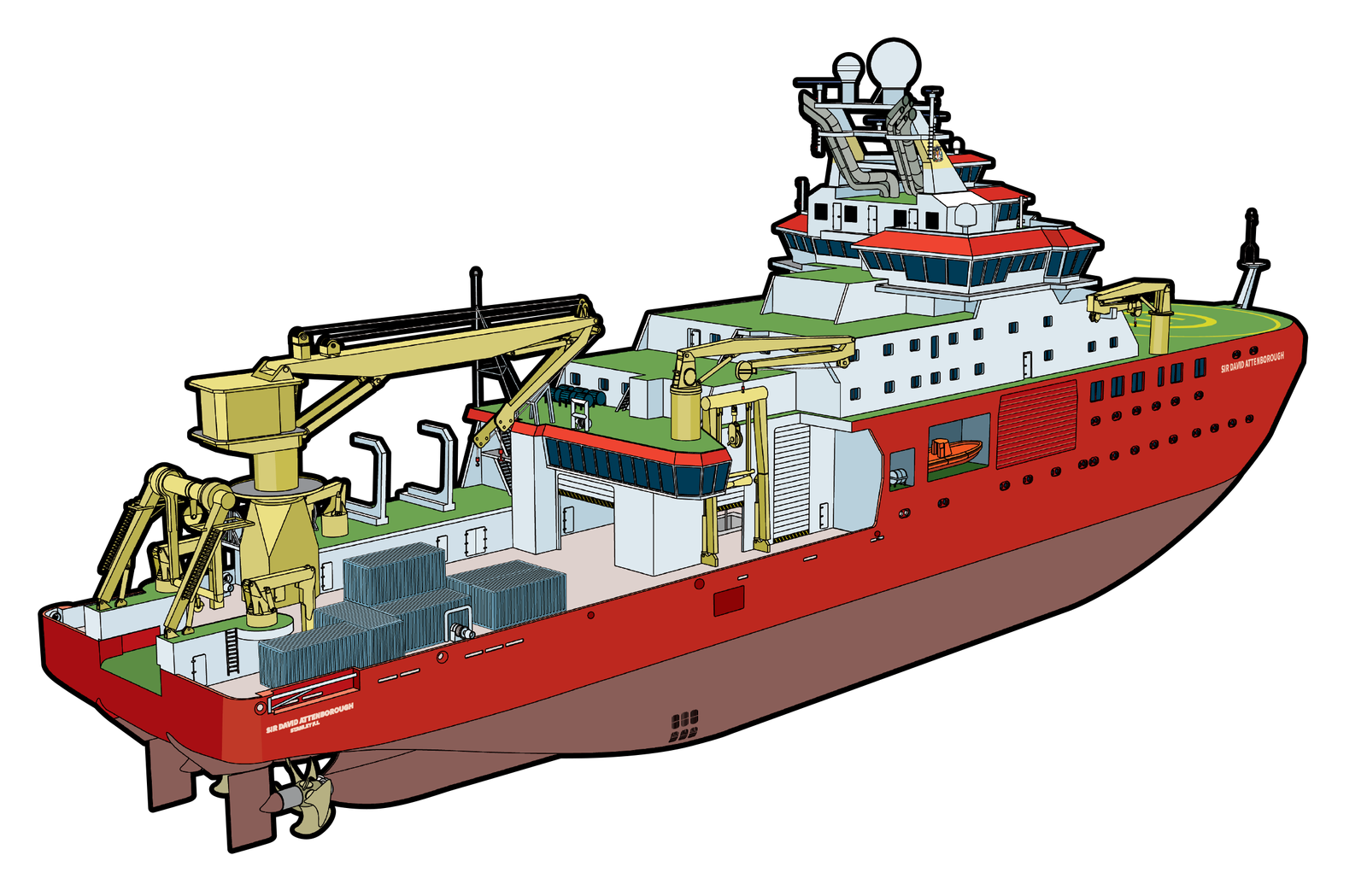
RRS Sir David Attenborough
The UK’s flagship icebreaker is a floating polar science hub — with a suite of laboratories, ample space for deploying equipment, and a heli-deck.
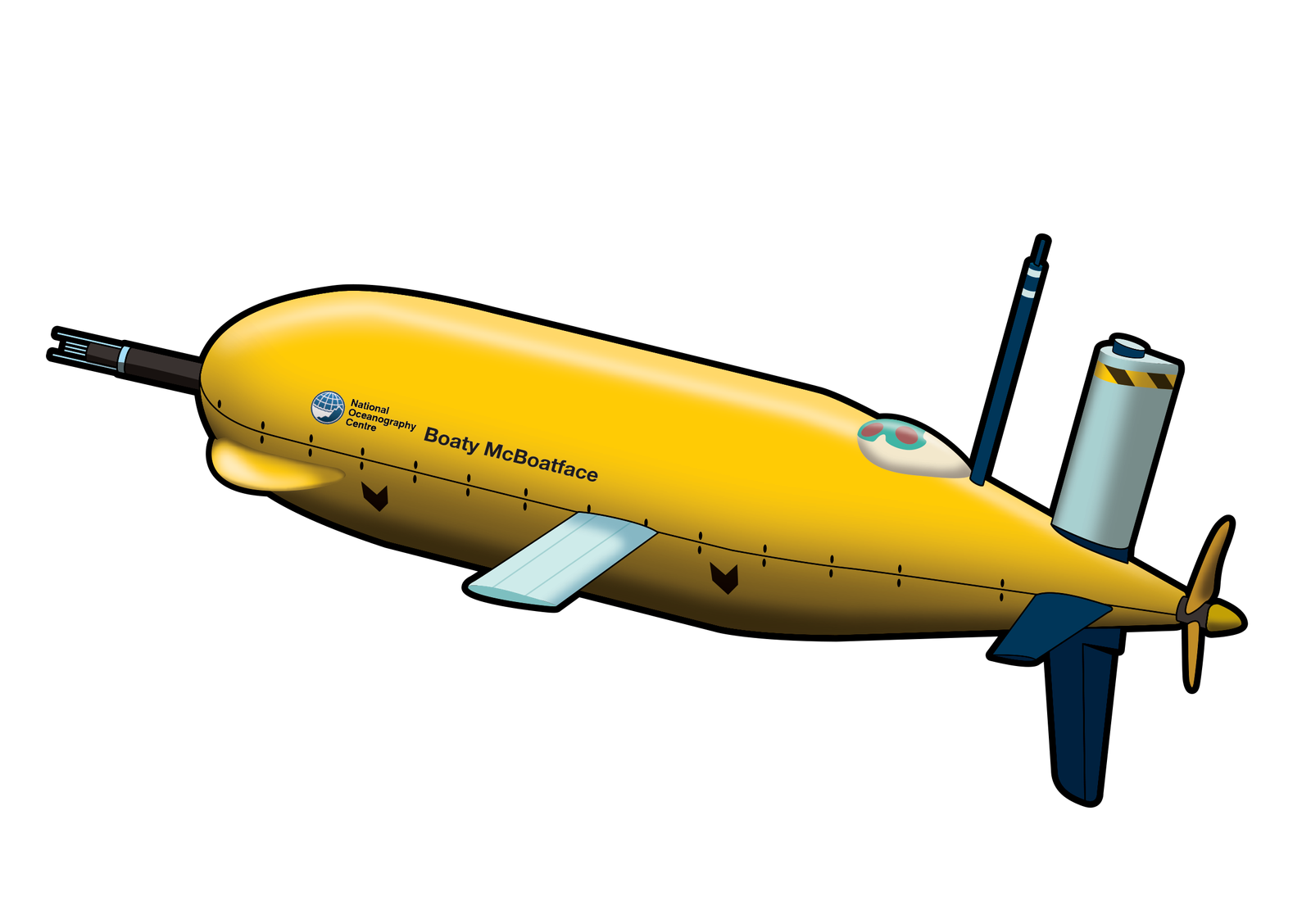
Autosub Long Range
‘Boaty McBoatface’ will dive deep below the glacial mélange, a region that is otherwise inaccessible, to map its geometry and impact on glacier behaviour.
Adios
These multi-sensor instruments are dropped from helicopters onto glaciers. They measure position, tilt, acceleration and internal ice layers to track strain, calving and melting.
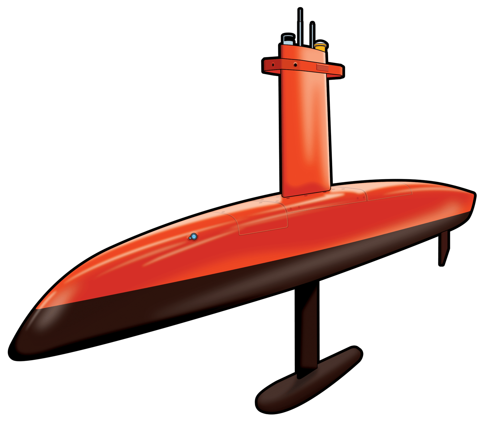
DriX
This surface-skimming robot maps the underwater glacier shape with scanning sonar. It tracks melt-rate changes and hourly ocean properties for days on end, offering flagship quality observations just next to treacherous glacier walls.
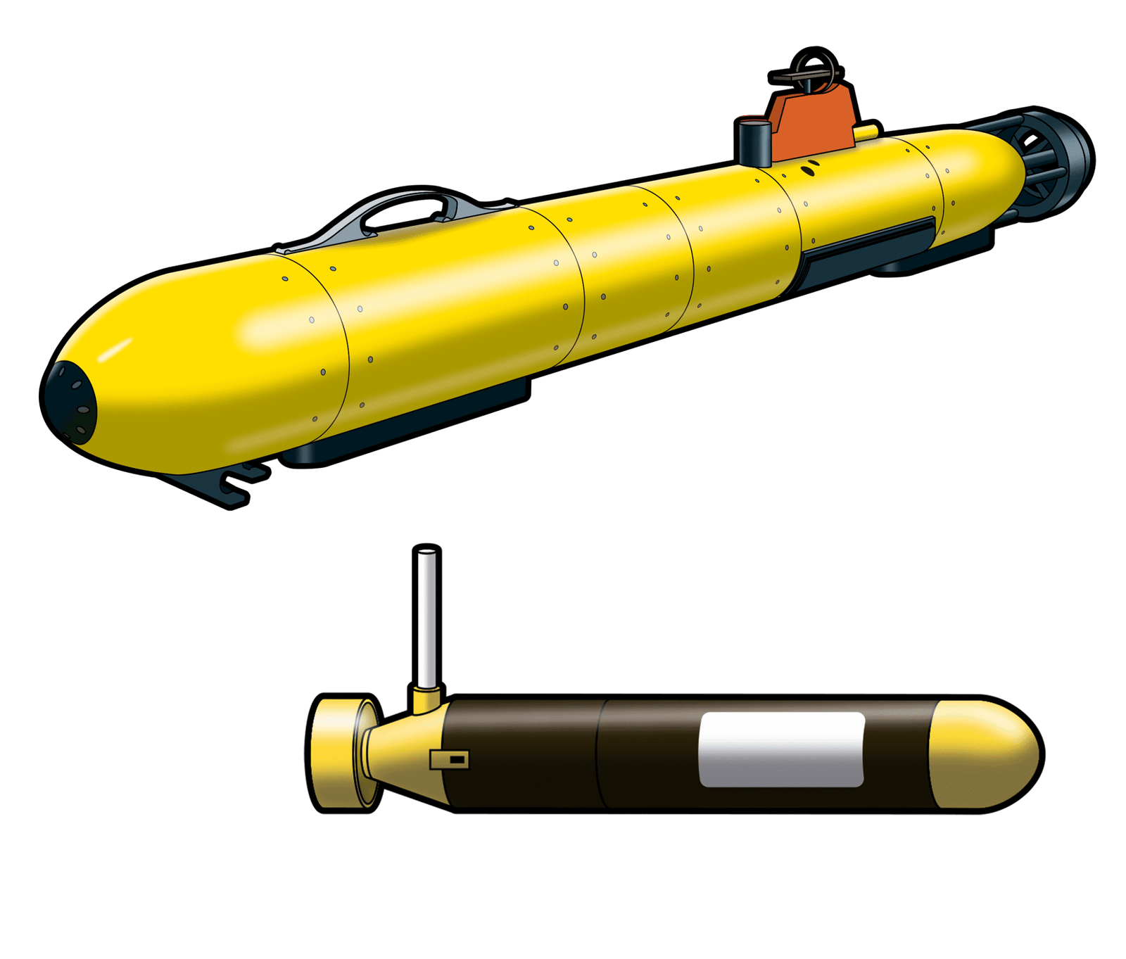
Gavia & EcoSubs
These robots can dive as a team to hundreds of meters depth and right up to the ice face, for a few hours. They will map the submerged glacier front and ocean property data, offering a complementary view to that provided by Drix.

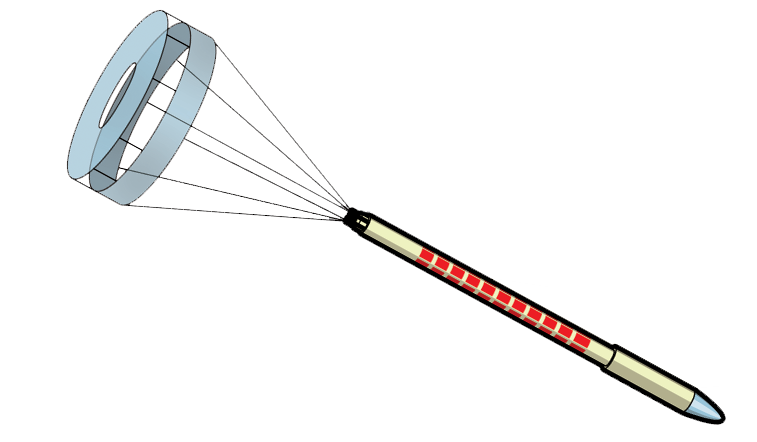
Meltstakes
These first-of-their-kind instruments measure melting directly on the ice face at a tiny scale. Drilled in at 50-100m depths, their sensors recover how waters transfer heat to the ice.
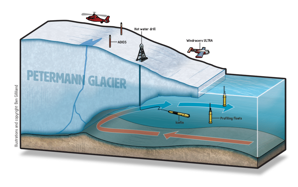
Petermann Glacier fieldwork
The RRS Sir David Attenborough In 2027, the focus will move north to Petermann Glacier, where the underwater vehicle Icefin will be lowered through a drilled access hole beneath the glacier’s floating tongue to study melting at the grounding line — the zone where ice begins to float.
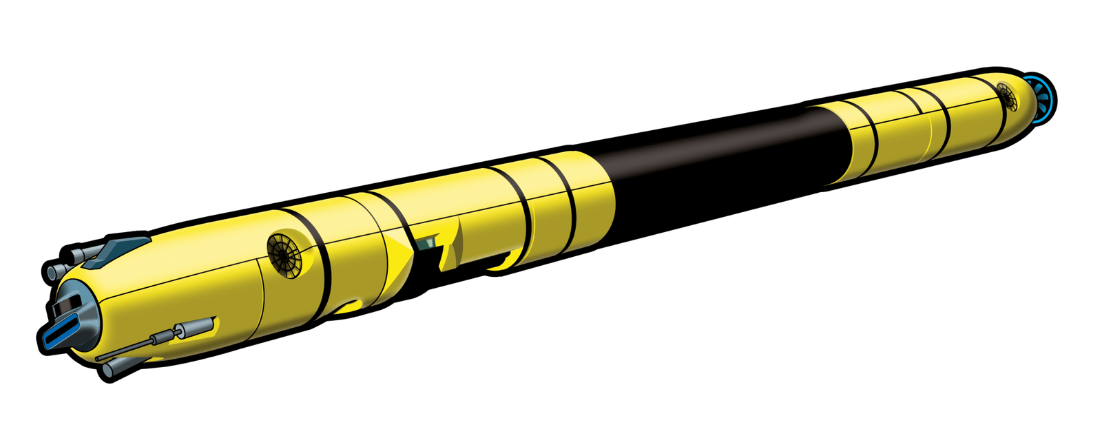
Icefin
A 3.5m underwater vehicle deployed through an ice borehole, it operates beneath the ice tongue and will study near-ice conditions and melting plumes.
Windracers Ultra
This 10m-wingspan drone will conduct long missions to map the surface of Peterman Glacier, use radar to find the grounding zone, and help identify where to deploy Icefin.
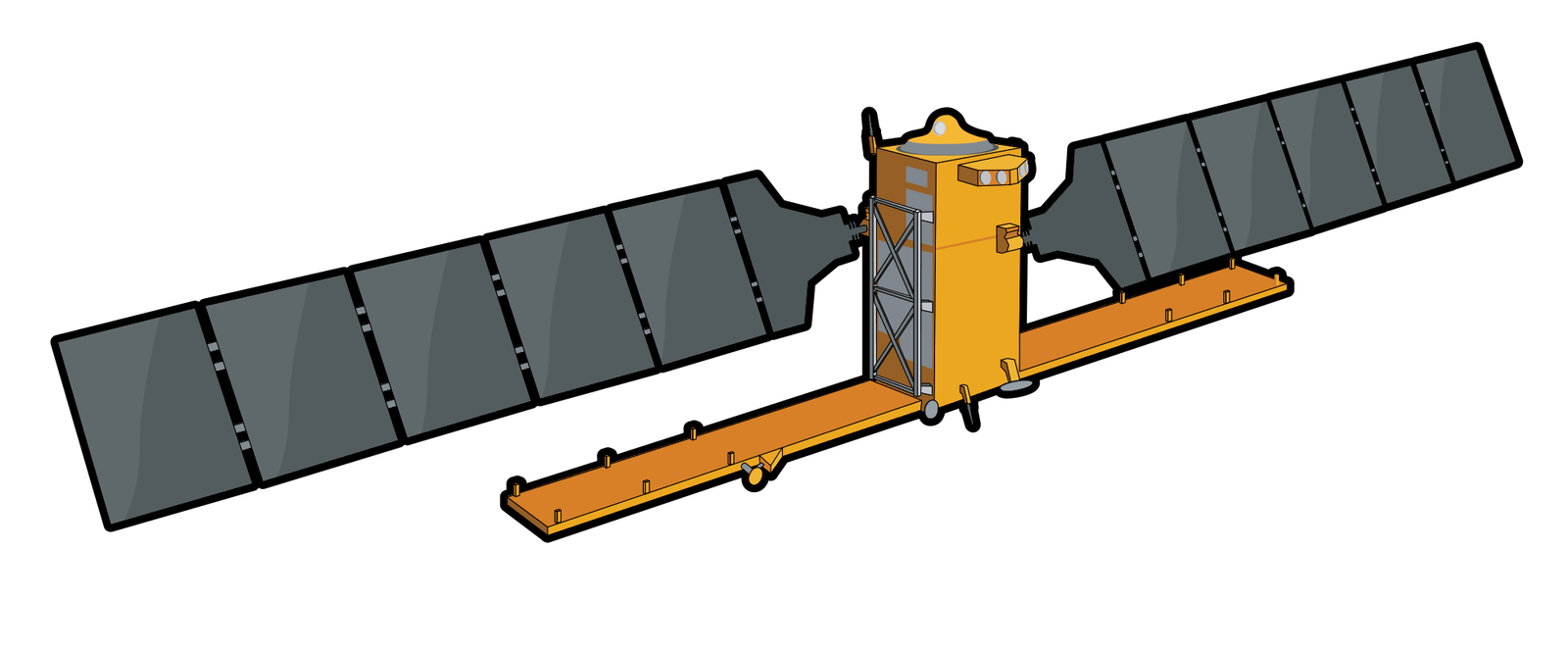
Satellites
ESA’s Sentinel programme provides a broad view of Greenland’s glaciers. They track glacier shape, motion and evolution, offering vital context for change.
“If we want to understand how glaciers melt and fracture, we need to be where the action happens — where the ice meets the ocean. The latest generation of robotic sensors are needed to work in this hazardous environment, which is otherwise impossible to access.”
Dr Pierre Dutrieux
Oceanographer British Antarctic Survey
+ GIANT Co-Creator